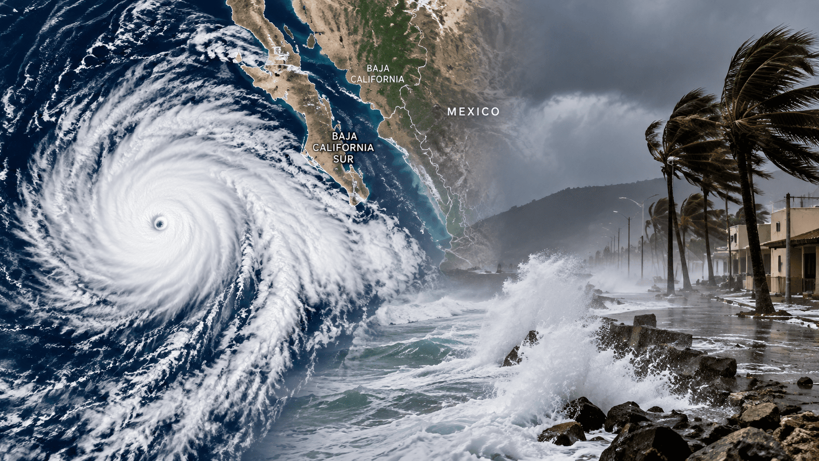
Hurricane Polo made landfall in Baja California Sur as a Category 2 hurricane after reaching Category 5 strength offshore with winds near 180 mph.
Hurricane Polo has made landfall in Baja California Sur after becoming one of the strongest hurricanes ever observed in the eastern Pacific. The storm reached Category 5 intensity offshore before weakening to Category 2 as it approached Mexico.
Hurricane Polo has made landfall on the west coast of Baja California Sur, Mexico, bringing hurricane-force winds, heavy rainfall, dangerous surf and the threat of flooding to parts of the peninsula.
The U.S. National Hurricane Center (NHC) reported that Polo moved ashore near Las Barrancas, in the municipality of Comondú, at approximately 06:00 UTC on September 29. At the time of landfall, the hurricane was estimated to have maximum sustained winds of 90–95 knots, making it a Category 2 hurricane on the Saffir-Simpson Hurricane Wind Scale.
The storm’s landfall came only days after Polo underwent an extraordinary period of rapid intensification over the eastern Pacific.
There is a footage recorded from Merchant Ship from hundred of miles away
Polo Exploded From a Tropical Storm Into a Category 5 Hurricane
One of the most remarkable aspects of Hurricane Polo was how quickly it strengthened.
NASA reported that Polo’s maximum sustained winds increased by approximately 90 knots (104 mph / 167 km/h) within 24 hours, taking the storm to Category 5 strength. The National Hurricane Center described the intensification as exceptionally remarkable.
Polo eventually reached maximum sustained winds of approximately 180 mph (285 km/h) and a central pressure near 892 millibars while over the Pacific.
That pressure placed Polo among the most intense hurricanes ever recorded in the eastern Pacific basin. NASA also reported that the storm’s rapid strengthening was among the fastest observed in the region.
The storm’s development was supported by unusually warm ocean waters. NASA reported sea-surface temperatures of up to approximately 32°C (90°F) in the region where Polo intensified, significantly warmer than normal for that time of year.
Why Polo Weakened Before Landfall
Despite its extreme peak intensity, Polo did not reach Baja California Sur as a Category 5 hurricane.
As the system moved northward and eventually turned toward the peninsula, environmental conditions became less favorable. Interaction with land also caused additional weakening.
The NHC estimated that Polo reached Baja California Sur as a Category 2 hurricane with winds of roughly 90–95 knots. After crossing the peninsula, the storm weakened further before moving into the Gulf of California.
This difference between peak intensity offshore and landfall intensity is important. A hurricane can undergo major changes in strength during the days between reaching its maximum intensity and reaching land.
Dangerous Seas and Storm Surge Hit Baja California Sur
Polo also created significant maritime hazards along the Mexican Pacific coast.
Ahead of landfall, authorities warned of dangerous surf, rip currents, storm surge and hurricane-force winds. The Mexican weather service reported waves reaching approximately 8 to 10 metres along parts of the Baja California Sur coast, while storm surge was estimated at around 1.5 to 2.5 metres in affected coastal areas.
These conditions created serious risks for coastal communities, fishing vessels and other maritime operations.
The NHC also warned that dangerous surf and rip currents would remain a concern along parts of the northwest coast of Mexico and Baja California.
For ports and smaller coastal vessels, conditions such as large breaking waves, strong onshore winds and rapidly changing sea states can make normal operations extremely dangerous.
Heavy Rain Brings Flooding and Mudslide Risks
Rainfall became another major threat as Polo moved across Mexico.
The NHC warned that heavy rainfall could produce life-threatening flooding and mudslides, particularly in areas with steep terrain. Baja California Sur and southern and central parts of Sonora were among the areas expected to receive significant rainfall.
Mexico’s weather service also forecast torrential rainfall in parts of Sonora, with some areas potentially receiving 150–250 millimetres of rain.
The combination of saturated ground, mountainous terrain and intense tropical rainfall can produce dangerous flash floods even after the strongest winds have started to weaken.
Polo Crosses the Peninsula and Heads Toward Sonora
After crossing Baja California Sur, Polo emerged over the Gulf of California.
By that stage, the hurricane had weakened to Category 1 intensity. The storm then continued northeast toward mainland Mexico.
The NHC forecast Polo to make another landfall in the Mexican state of Sonora, with the system expected to weaken rapidly after moving inland over the rugged terrain of northwestern Mexico.
That second landfall subsequently occurred near Guaymas, Sonora, on September 29. Reuters reported that Polo had weakened to a Category 1 hurricane with sustained winds around 75 mph as it moved into the region.
Authorities Opened Shelters Before the Storm
Mexican authorities prepared evacuation and shelter measures before Polo reached Baja California Sur.
Around 700 people were reported to have taken shelter in Baja California Sur during the storm, while authorities also deployed personnel and emergency resources in areas expected to be affected.
Early reports indicated that no deaths were reported in Baja California Sur from Polo’s landfall, although flooding, fallen trees and other damage were reported.
The storm had already caused fatalities elsewhere in western Mexico before reaching the peninsula, including deaths associated with flooding in Jalisco.
Polo’s Remnants Could Affect the United States
Polo’s effects are not expected to end at the Mexican border.
The NHC warned that the storm’s remaining circulation and moisture could contribute to heavy rainfall, flash flooding and strong winds across parts of the southwestern United States and southern Plains.
Forecast concerns extended into areas including New Mexico, Arizona and parts of Texas, where tropical moisture interacting with other weather systems could produce significant rainfall.
This is another example of how the impact of a powerful tropical cyclone can continue long after the storm has weakened below hurricane strength.
A Remarkable Hurricane in the Eastern Pacific
Hurricane Polo stands out because of the extraordinary changes it experienced during its life cycle.
The storm rapidly intensified to Category 5 strength over exceptionally warm Pacific waters, reached winds of approximately 180 mph, weakened substantially, and eventually made landfall in Baja California Sur as a Category 2 hurricane.
Its passage created a combination of high winds, dangerous seas, storm surge, heavy rainfall and flooding threats, affecting both coastal communities and maritime operations.
As Polo weakens over Mexico, attention is now shifting toward its remaining rainfall and flooding potential across northwestern Mexico and parts of the United States.